
Oyster Bay ZIP code coverage
Oyster Bay is a town with many postal labels, village contexts, and nearby Nassau delivery areas. The working crosswalk below records the Town-serving ZIPs identified in the research. It is not an official municipal-boundary-to-ZIP list. The post-office facility for each row was not separately verified, so the table preserves the community or USPS label and says where a street, parcel, or boundary check is still needed.
| ZIP | Areas covered | Post office | Oyster Bay note |
|---|---|---|---|
| 11545 | Glen Head | Not separately verified | Sixth Precinct community; boundary shares nearby municipalities. |
| 11547 | Glenwood Landing | Not separately verified | Town police geography; exact postal crosswalk needs a street check. |
| 11548 | Old Brookville / Greenvale area | Not separately verified | Village and community geography; verify the street in USPS. |
| 11560 | Locust Valley | Not separately verified | Town community label; confirm the delivery and Town line. |
| 11568 | Old Westbury | Not separately verified | Village-area label can cross Town context. |
| 11576 | Roslyn Heights area | Not separately verified | Adjacent-Town geography; not every address is in Oyster Bay. |
| 11577 | Roslyn | Not separately verified | Nearby postal area, not a blanket Town ZIP. |
| 11590 | Westbury | Not separately verified | Shared Nassau postal area; use GIS and SBL for the parcel. |
| 11709 | Bayville | Not separately verified | Town community and village context. |
| 11714 | Bethpage | Not separately verified | Town community and Eighth Precinct label. |
| 11732 | East Norwich | Not separately verified | Town community and Second Precinct label. |
| 11735 | Farmingdale | Not separately verified | Postal ZIP does not select the vital-record registrar. |
| 11749 | Plainedge / nearby service | Not separately verified | Check exact street and postal city. |
| 11753 | Jericho | Not separately verified | Town community; also serves boundary areas. |
| 11756 | Levittown area | Not separately verified | Shared Nassau postal geography; verify municipality. |
| 11758 | Massapequa | Not separately verified | Town community and Seventh Precinct context. |
| 11762 | Massapequa Park | Not separately verified | Postal label does not prove Town tax jurisdiction. |
| 11771 | Oyster Bay | Not separately verified | Hamlet and Town Hall postal context. |
| 11791 | Syosset | Not separately verified | Town community shared with Woodbury-area service. |
| 11797 | Woodbury | Not separately verified | Confirm the exact parcel line. |
| 11801 | Hicksville | Not separately verified | Town community and Eighth Precinct label. |
| 11802 | Hicksville PO box / alternate delivery | Not separately verified | Check whether the result is a street or box delivery. |
| 11803 | Plainview | Not separately verified | Town community and Second Precinct label. |
| 11804 | Old Bethpage | Not separately verified | Town community and Eighth Precinct label. |
No official source in the research published a complete Town-of-Oyster-Bay boundary crosswalk, ZIP populations, realignments, or a complete set of PO-box-only and unique ZIPs. Treat the table as a research map and validate the specific street before calling any ZIP entirely inside Oyster Bay.
Oyster Bay ZIPs are delivery geography
USPS ZIPs organize delivery, not town government. Oyster Bay includes hamlets, incorporated villages, and unincorporated communities. Brookville, Muttontown, Old Brookville, Oyster Bay Cove, and Old Westbury are incorporated villages within the broader Town geography. Farmingdale and Sea Cliff maintain separate vital records. Glen Cove is a separate city even where historical records and addresses touch the Town. Preserve municipality, hamlet or village, postal city, and ZIP as separate fields.
That distinction matters when a record is keyed to an address. A deed relies on the legal description, an assessment card on the situs and SBL, a tax notice on a mailing address, and a directory on a reported postal address. A ZIP can guide the next search, but it does not choose the right clerk, registrar, tax map, or public-record custodian.
Note: A postal result is useful confirmation of delivery language, but it cannot substitute for a parcel boundary or the legal description.
Finding Oyster Bay records by ZIP
A ZIP-focused search narrows an address investigation only when it stays tied to the specific parcel. The official tools captured in the research do not offer a one-click ZIP-wide resident export. The Nassau Land Records Viewer accepts ZIP as part of an address search, while the New York voter lookup uses ZIP as an individual search condition. Both are narrower tools than a public roster.
- Confirm the street's current postal city and ZIP with the USPS lookup.
- Enter the house number, street name, Town, and ZIP in LRV, or switch to the Section, Block, and Lot route if the address does not resolve.
- Open the LRV map and use parcel and place-boundary layers to identify the Town, village, or unincorporated-area context.
- Use the parcel's SBL and legal description for Clerk or permit research rather than using the ZIP alone.
- For an individual registration question, use the New York voter tool with its required county, name, date-of-birth, and ZIP or address inputs, respecting the stated restrictions.
Once a ZIP result has been narrowed to a street and parcel, the Oyster Bay Street Directory follows the address-to-parcel-to-deed sequence in more detail.
Oyster Bay ZIP fields in LRV
The Nassau Land Records Viewer is the ZIP-capable property tool documented for Oyster Bay. Its public screen provides an address route and an SBL route. The ZIP field belongs to the address route. LRV's instruction says to omit directional prefixes and street-type endings from the street field, and the form uses a CAPTCHA unless an account is used. The public screen did not expose an owner-name field.
| LRV field | Search path | ZIP research use |
|---|---|---|
| House Number | Address | Anchors the ZIP to an exact location. |
| Name of Street | Address | Enter without direction or street-type suffix. |
| Town | Address | Use the form's Town or mailing label. |
| ZIP | Address | Filters the address query; not a Town boundary. |
| Section / Block / Lot | SBL | Alternative parcel route when an address fails. |
| CAPTCHA / account | Conditional | Account bypass is stated by the LRV page. |
The LRV search form displays the address and SBL pathways used to add a ZIP to an Oyster Bay parcel search.
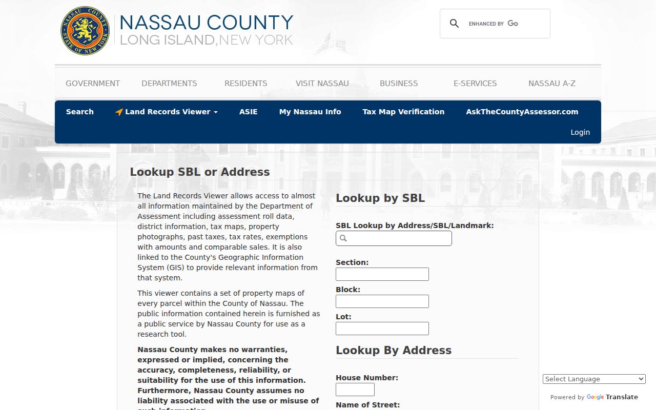
A result can include roll, class, land title, assessment, comparable-sale, and deed-reference context. It is a parcel assessment result, not a ZIP-wide directory of residents, and the visible fields vary by parcel and roll.
Validating an Oyster Bay ZIP with USPS
Use the USPS ZIP lookup to verify a street's current delivery label before beginning records work. The research also identifies the USPS FAST label-list record as a useful cross-check for postal city labels, but neither source defines a Town line. Dynamic results require normal browser interaction, so a result should be checked at the time of the search.
The USPS verification screen is the postal step for an Oyster Bay ZIP search.
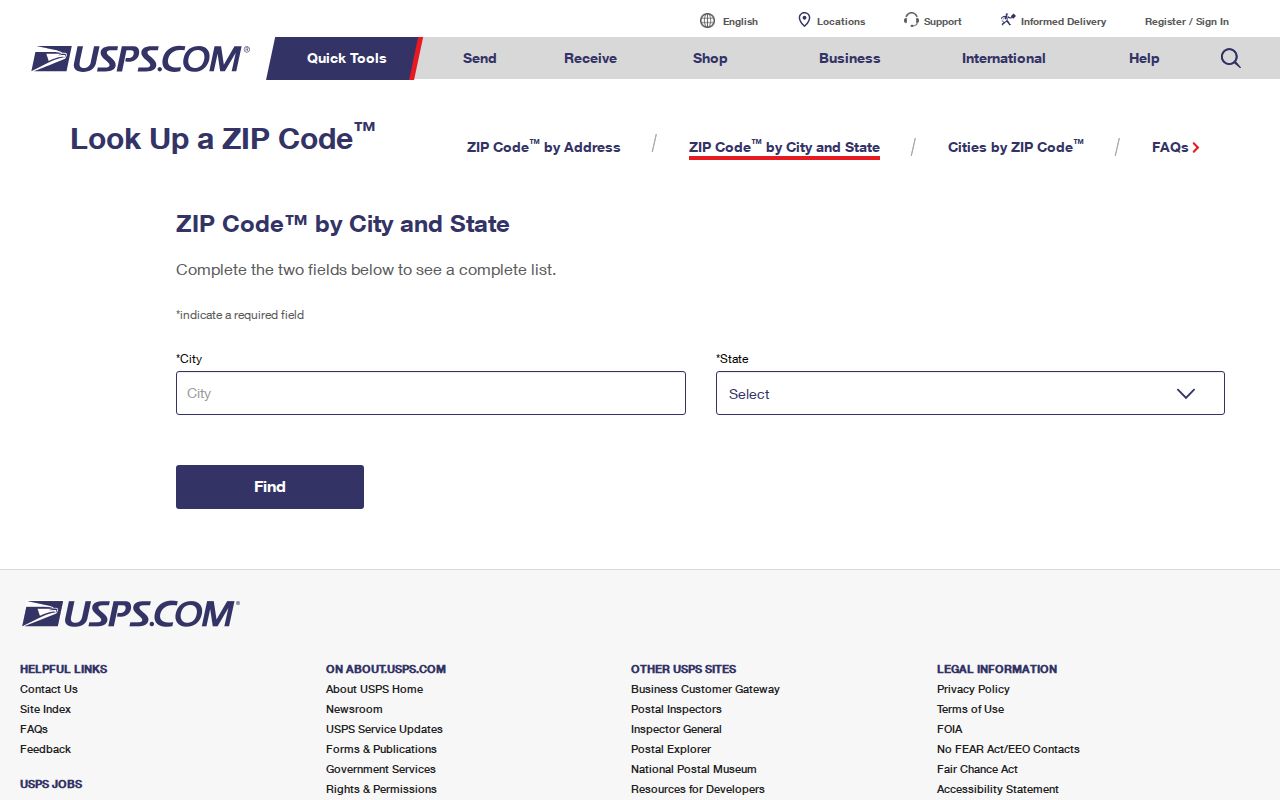
After USPS confirms the delivery language, keep the result with the original street spelling. Then move to LRV and GIS for parcel and municipal context, because an Oyster Bay-area label can span more than one government boundary.
Oyster Bay ZIP boundary checks in GIS
The Nassau LRV map supplies the next check after USPS. Search the address, turn on Parcels and Lots, then use Identify and the place-boundary layer. The map includes city, unincorporated-area, and village boundaries along with roads, parks, aerial imagery, Nassau 1926 and 1950 maps, and selected New York State layers. Parcel geometry and parcel keys are spatial evidence, not names of people at an address.
The Nassau GIS parcel map is the municipal-context companion to an Oyster Bay ZIP lookup.
Use the map to decide which parcel, municipality, and custodian should be researched next. The map's measurement tools and search controls do not turn a ZIP boundary into a list of residents.
Oyster Bay ZIP and registrar limits
Farmingdale and Sea Cliff are a clear Oyster Bay-area reminder that a postal community does not identify the records custodian. The Town of Oyster Bay Town Clerk and Registrar issues local birth, death, and marriage records for Town events except those incorporated villages. A 11735 mailing address may therefore be relevant to a separate Farmingdale registrar path. The ZIP does not determine who holds the local vital record.
For historical research, Oyster Bay's published 1847 to 1849 vital-record book is a surviving local source, while state and Town access rules still govern certificates and genealogy requests. Postal labels should remain part of the citation, but the event location and the responsible registrar decide the request route.
Oyster Bay ZIP terms
These terms keep delivery geography from being confused with the parcel or municipal record. They are especially useful where a Town of Oyster Bay address is described by a different postal city or where the same physical place has situs, mailing, and legal descriptions.
- ZIP
- A USPS delivery area used to route mail, not a Town or village boundary.
- ZIP+4
- An added delivery detail within a ZIP that does not change the governing municipality.
- PO-box ZIP
- A postal designation that may describe box or alternate delivery rather than a street location.
- Unique ZIP
- A ZIP used for a single institution or special delivery context; the research did not establish a complete local list.
- Carrier route
- A USPS delivery-routing concept, not a municipal or resident-record boundary.
A parcel's situs is where it sits. Its tax mailing address is where assessment correspondence goes. Its legal description and SBL are the land-record identifiers. Each can differ from the USPS label without creating a conflict in the underlying records.
Oyster Bay ZIP research and older labels
Historic directories and maps may use a postal city or pre-railroad locality that differs from the present USPS label. Retain the label found in the original source rather than replacing it with a modern ZIP name. Nassau GIS adds historic map layers, and the Library of Congress Sanborn material includes North Oyster Bay in 1885 plus Oyster Bay editions from 1891 through 1915. Those layers can explain address change over time without identifying a current resident.
The Census Oyster Bay profile is appropriate for broad town-equivalent statistics because it identifies the Town geography. It should not be replaced with a ZIP population figure, since ZIP delivery areas and Town boundaries are different shapes.
Where Oyster Bay ZIP codes do not match the Town
ZIP boundaries and Oyster Bay municipal boundaries regularly answer different questions. A 11791 mailing address can be associated with a 11771 parcel, while a 11735 mailing address can lead to Farmingdale's separate registrar. Similarly, an address in a shared Roslyn, Westbury, Levittown, or Hicksville postal area needs its parcel municipality checked before a Town record is requested.
A documented mismatch is useful information. Record the postal label, situs address, SBL, and municipal context together, then ask the appropriate office for a specific existing record. That method avoids turning a delivery route into a false claim about jurisdiction or residence.