
Finding people along an Oyster Bay street
Use one Oyster Bay address as the start of a short evidence chain. The Nassau County Department of Assessment identifies the parcel and assessment context. The map places that parcel among lots and municipal boundaries. The Nassau County Clerk then supplies the recorded-instrument path. Each source answers a narrower question. A parcel card can link to a deed reference, while a deed records a conveyance rather than who occupies the structure. That distinction keeps a street-by-street search tied to records rather than assumptions.
- Enter the situs address in the Nassau Land Records Viewer, or use the Section, Block, and Lot when it is already known.
- Open the same location in the LRV map, turn on Parcels and Lots, and identify the parcel key and adjacent polygons.
- Record the liber/page or deed reference shown on a parcel result, along with the SBL and legal description.
- Use the Clerk land-record route to follow the grantor and grantee sequence for the same lot, checking the legal description at each transfer.
- For older address evidence, ask the library or historical repositories about reverse directory, census, newspaper, obituary, and map holdings rather than treating a current parcel record as a household census.
New York's voter tool is an individual current-status lookup. It does not offer an all-voters-on-an-Oyster Bay-street result. A fuller voter-file request has election-purpose and use restrictions, so it is not a substitute for this address chain.
Entering an Oyster Bay street in LRV
The Land Records Viewer is the practical first stop for a modern Oyster Bay address search. Its public form is titled SBL Lookup by Address/SBL/Landmark. It accepts an address route or an SBL route, not a verified public owner-name search. Nassau directs address users to leave out directional prefixes and street-type endings such as Road, Street, and Avenue. A CAPTCHA appears unless the user has an account.
The Nassau LRV search form is the address-and-SBL starting point for an Oyster Bay parcel query.
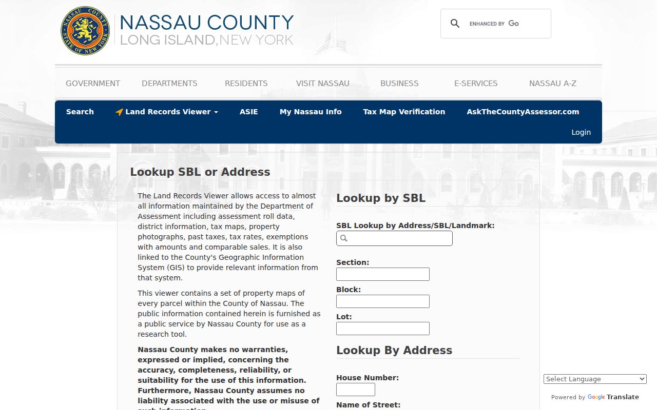
The form keeps an address route and an SBL route separate. Use the route supported by the record in hand instead of assuming a name can be searched directly.
| LRV field | Route | How Oyster Bay searches use it |
|---|---|---|
| Section | SBL | First parcel component when an SBL is available. |
| Block | SBL | Second parcel component; Clerk formatting can differ. |
| Lot | SBL | Third parcel component for the specific lot. |
| House Number | Address | Enter the number as used in local addressing. |
| Name of Street | Address | Omit directional text and street-type endings. |
| Town | Address | Use the town or mailing label supplied by the form. |
| ZIP | Address | A filter, not proof of a municipal boundary. |
An LRV result can display roll year, land title or category, class code, school and SWIS codes, lot grouping, assessment and comparable-sale context. The visible fields vary by parcel. No owner-name input was found on the public screen, and the research did not establish that a signed-in version adds one.
Note: An SBL that works in the assessment viewer may need different placeholders when it is carried into the Clerk's land-record research.
Oyster Bay street parcels on the map
The LRV map is the spatial part of an Oyster Bay by-address search. Search the known address, enable Parcels and Lots, zoom to individual polygons, then use Identify for each parcel being examined. The map can show roads, place boundaries, parks, aerial imagery, FEMA flood zones, Nassau 1926 and 1950 maps, and New York State map layers. Its parcel service exposes parcel identifiers, parcel address, roll year, and geometry. It does not expose a resident name.
The Nassau LRV map shows the parcel, layer, and identification controls used for an Oyster Bay map review.
Use the image as a reminder to collect parcel keys one at a time. The map's Search in control and measurement tools help navigate geography, but they are not a radius-based people search or a public street roster.
Oyster Bay records keyed to an address
Several Oyster Bay records can be connected to the same physical place, but their meanings differ. Assessment data describes a parcel. GIS supplies the polygon and map context. Recorded deeds identify parties to a legal transfer. Permits and code files can put dated municipal activity at an address. The coverage below keeps the most useful street-record paths and their limits together.
| Address record | Custodian | Useful street evidence | Access and limit |
|---|---|---|---|
| LRV assessment card | Nassau Assessment | Roll, class, land title, deed reference, tax context | Free address/SBL search; not all occupants. |
| Parcel and lot map | Nassau GIS | Parcel key, address, polygons, boundaries, historic layers | Free map; names require a separate record route. |
| Recorded land instrument | Nassau County Clerk | Parties, date, legal description, document or liber/page | Electronic database from July 1992; older paths may be needed. |
| Tax map | Clerk map room / GIS | SBL, lot lines, condominium, co-op, or wetlands context | Map room and GIS; verify units and subdivisions. |
| Town permit | Planning and Development | Application, work, inspection, and issue-date evidence | Portal or existing-record request; applicant is not necessarily an occupant. |
| Code investigation | Town Code Compliance | Address and reported condition category | Form or FOIL route; a complaint is not a finding. |
The property trail should preserve the exact address spelling, the SBL, and the legal description. A tax-mailing address may belong to an owner, fiduciary, or lender-related contact and may sit outside the property ZIP. It should not be recast as a list of people living on the street.
Oyster Bay street record terms
Street and land records use terms that separate the physical location from the filing history. Reading them correctly makes an Oyster Bay by-address search easier to repeat and less likely to join a similar number, unit, or subdivision by mistake.
- Parcel
- A mapped piece of land represented in the assessment and GIS systems.
- Situs address
- The physical address where the parcel sits, distinct from a tax-mailing address.
- Plat or tax map
- A mapped representation that helps relate an SBL, lot boundaries, and a subdivision.
- Section, Block, and Lot
- Nassau's parcel components, often shortened to SBL, used to confirm the same property across systems.
- Criss-cross directory
- A reverse directory arranged by address, used as historical address evidence when a relevant volume exists.
Assessment and Clerk systems can display SBL placeholders differently. The legal description and the map provide the stronger bridge when the street wording or parcel formatting does not match.
Following an Oyster Bay deed chain
After the parcel is identified, the Nassau County Clerk land-records office is the source for the recorded chain. Start with the most recent deed, note the document number or liber and page, recording date, grantor, grantee, and legal description, then search the current owner as grantee for the prior conveyance. Confirm the same SBL and legal description before moving backward. A deed proves a transfer. A mortgage, lien, or satisfaction documents another legal event, not a move.
The county-linked Nassau land-record search is the electronic-era route. The field labels, image cutoff, and fee tiers were not safely captured in the research, so they are not assumed here.
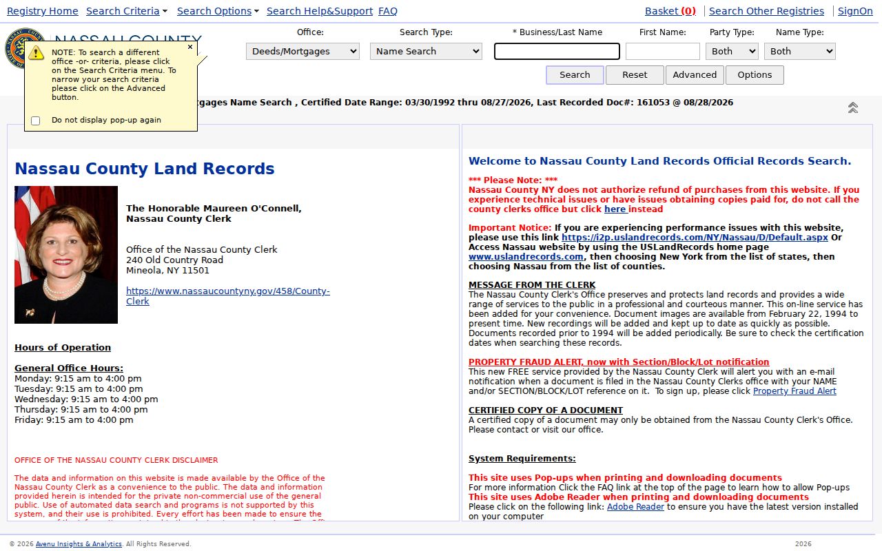
The Clerk booklet dates the electronic land-record database to July 1992. For older instruments, the separate Nassau Clerk Files portal labels Historic Official Records from 1840 to 1982, and Clerk room B-1, the map room, mail, or a written request may provide the next path. The overlap and online image availability need record-by-record verification.
Oyster Bay street permits add dates
Town permits can add a dated layer to an Oyster Bay address-record trail. The Building Portal supports permit applications, fees, inspection results, and related responses. A Town sample record includes an SBL, site address, property-owner and mailing details, contractor information, permit number, and issue date. Those fields can bracket work such as an addition, pool, generator, or solar installation.
Code Compliance's investigation form also asks for a premises number, street, Town, ZIP, nearest cross street, and optional SBL. A submitted code complaint is an allegation, not a final determination. Request the disposition before relying on a report, and keep the permit applicant separate from the question of who occupied the site.
Note: Permit dates are address history evidence, while the public record does not make every person named on an application a current resident.
Oyster Bay street evidence beyond parcels
The New York Voter Registration Look-up requires county, name, date of birth, and ZIP or address information for a current individual lookup. It can return registration or polling information, but it cannot establish everyone at an Oyster Bay address. New York permits selected voter-file information under Election Law rules, yet a request must state an elections purpose and protected addresses and identifiers are withheld.
For older street evidence, reverse or criss-cross directories can be more useful when a volume is available. NYG&B identifies Nassau directory leads for 1868 to 1869 and 1909 to 1913, while HeritageQuest has directory material at the platform level. Confirm the local run with library staff before stating that a particular Oyster Bay address appears in a volume. Census, newspapers, obituaries, cemetery records, and probate records can bridge a gap, but each documents a different relationship to a place.
When the question shifts from a named street to a historical directory collection, the Oyster Bay Directory Book provides the focused collection route.
Oyster Bay street names and postal geography
Oyster Bay is a town of hamlets, villages, and unincorporated communities, so a mailing city is not a municipal finding. The map's place-boundary layer helps separate city, unincorporated-area, and village context. A 11771 Oyster Bay address, a 11791 Syosset address, or a 11801 Hicksville address can all fall within the Town's broad service geography, while the correct registrar, tax map, or police department may differ by the parcel line.
Use the SBL and municipal-boundary layer after the postal address is validated. That is especially important where Farmingdale or Sea Cliff have separate vital-record custody. An Oyster Bay address search should retain the original postal and historic locality labels rather than silently rewriting them to fit one modern town label.
When an Oyster Bay street search stops
If the address route fails, try the SBL from a deed, tax bill, permit, or map. If the electronic deed sequence ends, use the historic-files route, Clerk map room, grantor/grantee books, or a documented request to the Clerk. County procedures allow land-document recording and document requests by e-recording, mail or delivery, lobby drop box, and in-person channels; the research also places land-records room B-1 and the map room in the Clerk's basement.
For a Town-held record that is reasonably described but not online, the fallback is a request under the New York Freedom of Information Law, Public Officers Law Article 6. Agencies can withhold personal information and records protected by another statute. A request should identify the address, record type, date span, and SBL where known, rather than ask for a general list of people on a street.
Limits of the Oyster Bay street directory
Public address records will not reliably identify every occupant, private renter, household member, delivery or utility customer, unregistered voter, protected voter, or Address Confidentiality Program participant. DMV address information is closed under the federal DPPA. A trust, estate, or company can be a deed grantee; a permit applicant may be a contractor; and an assessment mailing address can be elsewhere. A missing name is not an invitation to reconstruct a protected address.
Keep a source, date, and record relationship for each finding. That approach distinguishes a parcel owner, mail recipient, historical resident, and current occupant instead of presenting any one record as certainty.